
Global warming is increasingly contributing to the frequency and intensity of weather events, resulting in significant consequences for the U.S. Rising seas and rain events that can last for days are causing flood events threatening quality of life. Roads are washed away and infrastructure, utilities, and emergency services are all at risk from these worsening weather events. Reliable infrastructure is essential to the economic prosperity, sustainability, and security of communities across the United States.
Last month the First Street Foundation released its third national risk assessment, Infrastructure on the Brink, in which flood risk vulnerability is measured by city and county. In-depth information for Massachusetts’ at-risk neighborhoods by zip code, city, and county can be found at FloodFactor.com.
The report establishes the following operational risk categories: residential, roads, commercial, social, and infrastructure. The report further considers operational risk for communities through operational risk today by municipality, operational risk today by county, and percent increase in operational risk over the next thirty years, by county. In Massachusetts, Quincy does not appear on the top-ten list of Massachusetts cities at risk, and Norfolk County is the county at lowest risk today. Still, in 2021, in Norfolk County, there is an operational risk of damage to 11.7% of residential properties, 21.1% of miles of roads, 22.5% of commercial properties, 25.3% of infrastructure facilities, and 16.4% of social facilities. Over the next thirty years, the proportion of properties, roads, and other facilities with operational risk is projected to increase. This means more residential properties at risk of flooding; additional miles of roads becoming impassable; more commercial buildings at risk of water reaching their doors; more government, educational, and social facilities at risk of becoming inoperable due to flooding; and more emergency services, utilities, police, fire departments, power stations, and waste management at risk of becoming inoperable.
Given this, it’s imperative that Quincy residents are aware of the city’s weather emergency plans and preparations. The city’s Emergency Management webpage contains information about Quincy’s emergency and hazard mitigation plans. On the left column are links to information about Alert Quincy, the Community Emergency Response Team, Emergency Preparedness, the Emergency Operations Center, Evacuation / Safety Plans, and other topics.
It is equally important that Quincy’s leaders are aware of the increased frequency and intensity of weather-related events in Quincy, continue to work to identify areas of vulnerability to extreme weather events, and make plans to mitigate these.
In 2019, Quincy took advantage of state and FEMA grants to assess the impacts of climate change in the city. Those vulnerability assessments were incorporated into the city’s Multi-Hazard Mitigation Plan. The Municipal Vulnerability Plan Quincy conducted recommended three areas needing improvement if Quincy is to increase its storm resilience:
HIGHEST PRIORITY: Emergency communication system; emergency power generation; storm water pump stations; seawall construction; building inspection records system; tide gate construction and management plan; public education and post disaster support.
MODERATE PRIORITY: Drainage improvements; hurricane barrier evaluation; tree removal equipment; slope protection and infrastructure hardening; sewer system modernizations; sewer system interceptor relief.
LOWEST PRIORITY: Coastal buffer maintenance; salt marsh restoration; seismic impact evaluation and gas utility study; O’Rourke Field conversion.
More information can be found in the full Quincy Hazard Mitigation Plan, the plan’s summary, the neighborhood summaries, and the Community Asset Dashboard.
The city has done a good job of highlighting its weak areas in terms of severe weather resilience. However, given the increasing threats of flooding in the not-so-distant future, I wonder where Quincy’s climate resiliency priority projects stand? Should there be public reporting of progress? Has a timeline been developed for completing each of the projects, particularly those considered highest priority? Perhaps a newsletter could be sent to all Quincy residents updating us on the start and completion of this work?
Also, I wonder how many in Quincy are aware of the resources available on Quincyma.gov regarding natural and manmade disasters? Could QATV be of help in getting this information out to more residents? Should libraries have printouts of Quincy’s disaster-preparation information on hand for residents to take?
All in all, I think Quincy is on the right track. Quincy has many important priorities in terms of governance, but I think protecting Quincy’s residents and infrastructure should be one of the highest.
– Ida DelVecchio, QCAN member
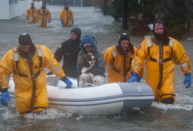
IMAGE: National Guard rescuers evacuate a resident and dog from their home in Quincy during a 2018 winter storm. (Photo: Spc. Samuel Keenan, CC NU 2.0 license)
